MASTER PLAN 2031
UTTAR PRADESH
GIS-Based Urban Planning & Infrastructure Development
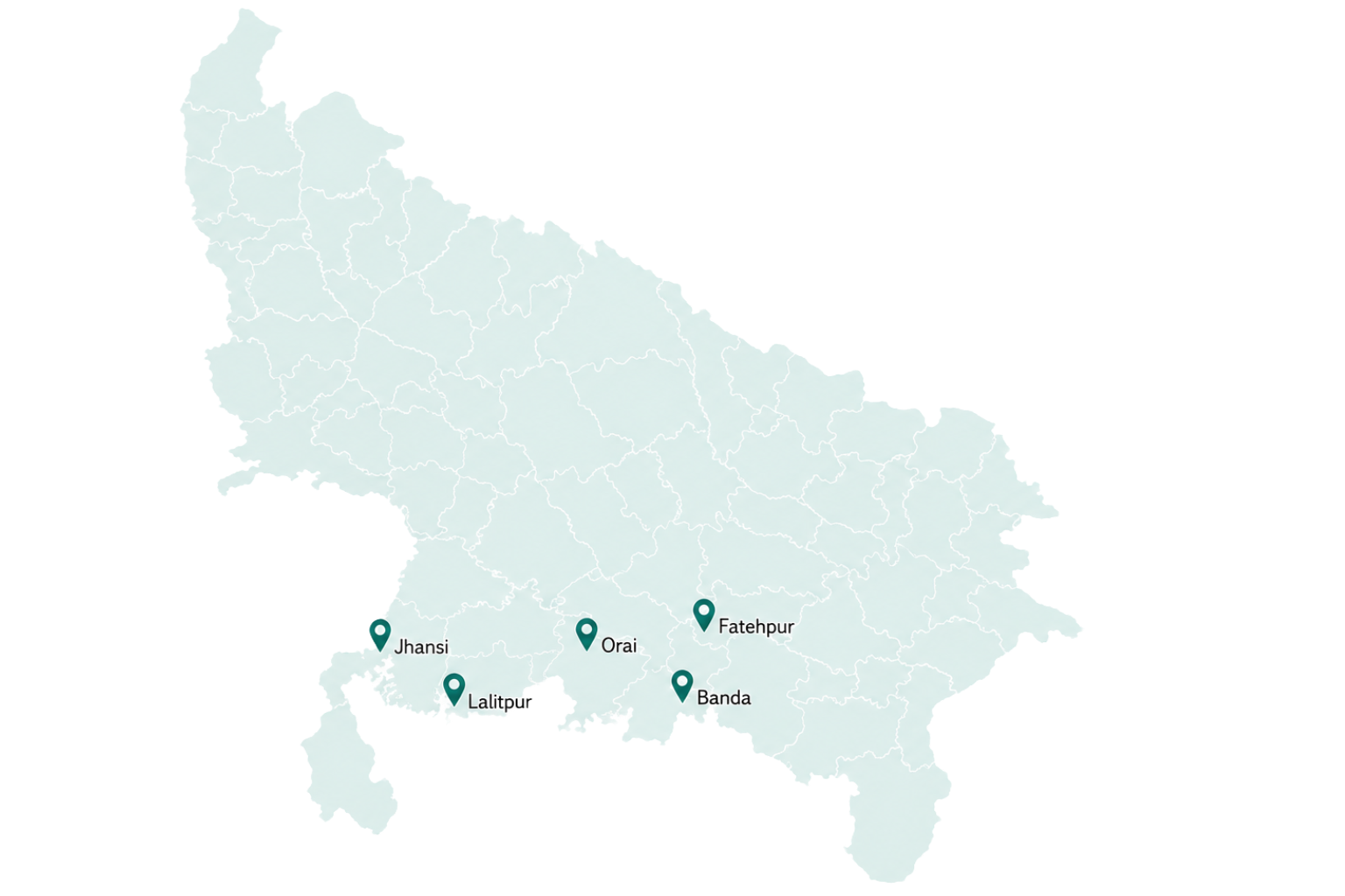
Coverage
Project Discription
Approach & toolkit
- Primary & secondary data collection
- Stakeholder workshops & discussions
- Advanced spatial data analysis
- ArcGIS dynamic blueprint & zoning
Strategic pillars
- Mobility networks & infrastructure
- Government / private investment priorities
- Zoning regulations & regularisation
- Environmental safeguards & liveability
HighLight
To keep pace with rapid urbanisation, the cities of Jhansi, Lalitpur, Banda, Orai, and Fatehpur required a forward-looking strategy to guide their growth. Citiyano De Solutions was awarded the project by U.P. State Government to prepare a comprehensive GIS-based Master Plan for 2031, covering 1,338 sq. km. with a population of approx. 12 lakhs. By this project a robust, technology-driven and solution based framework was formed, helping in decision-making for spatial development of Indian towns/ cities.
Our approach comprised data collection from primary and secondary sources, focused stakeholder’s discussions/ workshops, advanced data analysis, where ArcGIS- the toolkit played a vital role in creating a dynamic blueprint for urban development. The project identifies infrastructure improvements within the proposed study areas, proposes government/ private investment priorities and establishes zoning regulations to ensure regularized city development. By integrating mobility networks, utility systems and environmental safeguards, the AMRUT Master Plan projects ensure the cities are prepared for future economic sustainability and demographic shifts while maintaining liveability for all citizens.
Scope
- Geographical Coverage: 1,338 sq. km. across five cities—Jhansi, Lalitpur, Banda, Orai, and Fatehpur.
- Population Served: Over 13.73 lakh residents.
- Base Map Creation: Developed high-accuracy base maps using ArcGIS and ERDAS Imagine.
- Primary & Secondary Surveys:Conducted comprehensive field surveys to assess existing urban conditions and infrastructure gaps.
- Data Analysis: Analysed demographic trends, land-use patterns, and service delivery metrics.
- Infrastructure Proposals: Formulated detailed plans for water supply, sewerage, drainage, roads, and public facilities.
- Regulatory Frameworks: Prepared development control regulations and land-use zoning guidelines.
- Investment Prioritisation: Identified and prioritised projects based on urgency, impact, and feasibility.
- Stakeholder Engagement: Collaborated with municipal authorities, state agencies, and community representatives.
- Duration: 18 months of intensive planning and stakeholder coordination.
Impact
- Transformed urban governance from reactive, ad-hoc decision-making to a structured, data-backed planning approach.
- Enabled targeted infrastructure investments, ensuring public funds are directed to high-priority projects with maximum community benefit.
- Strengthened disaster resilience by incorporating environmental safeguards and climate-adaptive design principles.
- Improved inter-departmental coordination by creating a unified spatial framework for all urban development activities.
- Enhanced transparency in land-use decisions, reducing ambiguity and potential for disputes.
- Promoted equitable access to basic services—water, sanitation, roads, and drainage—across all income groups.
- Reduced urban sprawl and associated environmental degradation through clear development control norms.
- Boosted investor confidence by providing regulatory clarity and a predictable growth trajectory.
- Empowered local communities by making planning documents accessible and participatory.
- Created a replicable planning model for other cities in Uttar Pradesh under the AMRUT mission.