MASTER PLAN 2031
HIMACHAL PRADESH
GIS-Based Urban Planning & Infrastructure Development
Coverage
HighLight
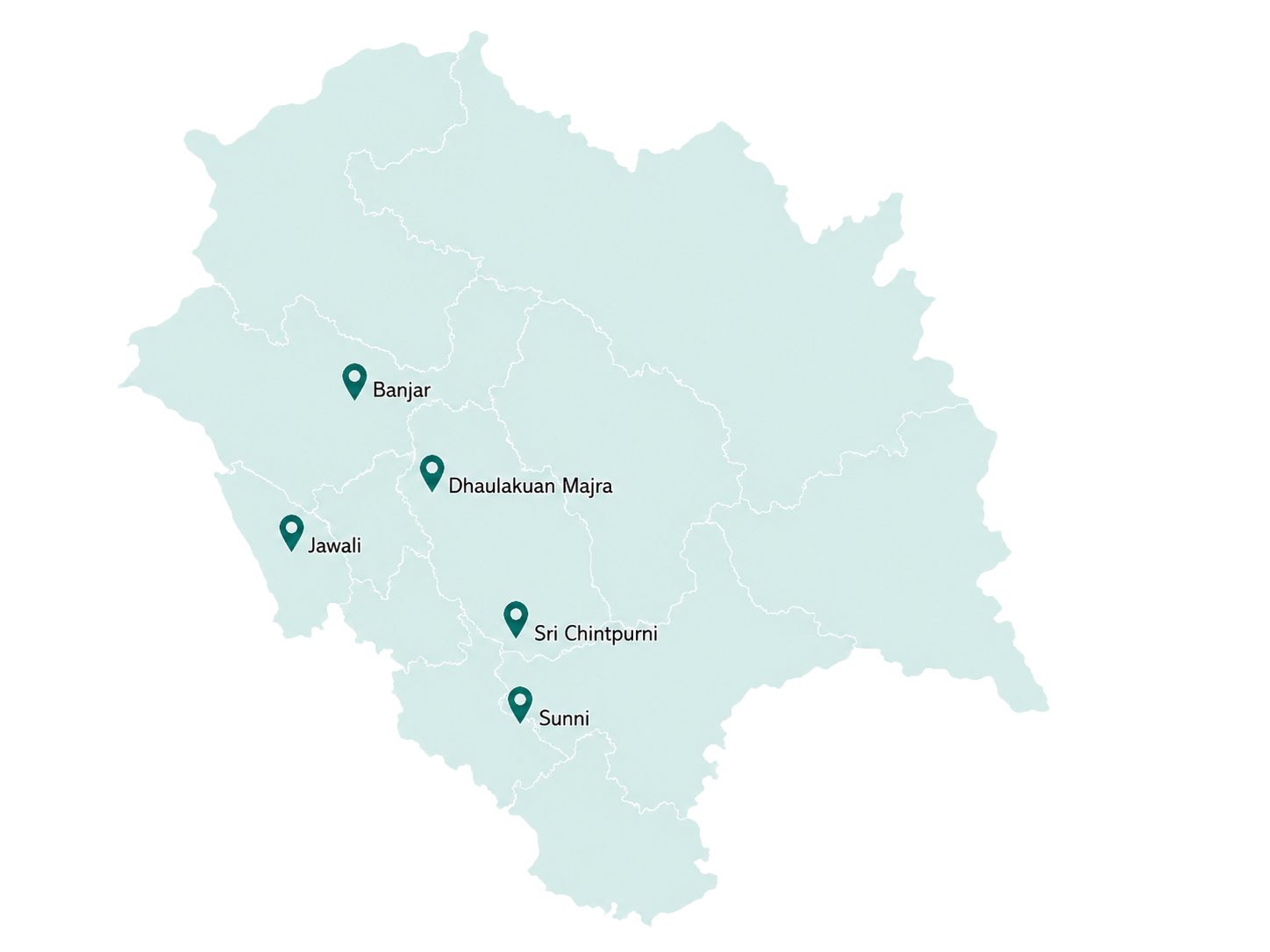
Planning for hill towns requires a delicate balance between development and ecological preservation. For Sri Chintpurni, Dhaulakuan Majra, Jawali, Sunni, and Banjar, Citiyano De Solutions prepared strategic development plans under the Town and Country Planning Organisation (TCPO) framework. The project spans diverse geographies, covering 971 hectares around the Chintpurni temple complex and 31 sq. km. in Dhaulakuan Majra, encompassing 15 revenue villages.
Our team created spatial databases and policy frameworks tailored to the state’s sensitive topography and cultural heritage. The plans address infrastructure augmentation, tourism management, and disaster resilience while respecting local communities and environmental constraints. By creating clear physical proposals and investment blueprints, we have provided a structured path for growth that unlocks economic potential without compromising the region’s natural assets.
Impact
- Preserved ecological integrity by integrating environmental safeguards into development frameworks.
- Enhanced tourism potential through structured infrastructure upgrades and heritage conservation measures.
- Strengthened disaster preparedness with climate resilient design strategies specific to hill towns.
- Improved quality of life for residents by addressing critical gaps in roads, water supply, and sanitation.
- Protected cultural heritage sites such as the Sri Chintpurni temple complex through sensitive planning.
- Boosted local economic opportunities by creating supportive conditions for small businesses and tourism.
- Fostered community ownership through inclusive stakeholder engagement throughout the planning process.
- Reduced unplanned construction and landuse conflicts through clear regulatory guidelines.
- Enabled better interdepartmental coordination among state agencies for project implementation.
- Created a planning template that can be adapted for other towns in Himachal Pradesh.
Scope
- Geographical Coverage: Sri Chintpurni (971 hectares, 13 villages); Dhaulakuan Majra (31 sq. km., 15 revenue villages); Jawali, Sunni, and Banjar.
- Spatial Databank Development: Created a comprehensive repository of spatial data for informed decisionmaking.
- Policy Frameworks: Formulated regulatory guidelines and investment prioritisation strategies.
- Infrastructure Planning: Proposed physical proposals for roads, utilities, and public amenities.
- GISBased Mapping: Utilised spatial tools for land use analysis, zoning, and development planning.
- Stakeholder Engagement: Collaborated with TCPO, municipal authorities, and local communities
- Tourism & Heritage: Integrated tourism circuit planning and conservation facility upgradation.
- Disaster Resilience: Incorporated mitigation measures for landslides, floods, and seismic risks.
- Economic Development:Identified economic zones to support local livelihoods